REAL

Resilience in East African Landscapes

  • Welcome
  • About us
  • People
    • Advisory Board
    • Researchers
      • David Anderson
      • Franziska Bedorf
      • Michael Bollig
      • Lowe Borjeson
      • Colin Courtney Mustaphi
      • Benoit Hazard
      • Paul Lane
      • Rob Marchant
      • Dirk Verschuren
      • Mats Widgren
    • Early Stage Researchers
      • Christine Adongo
      • Maxmillian Chuhila
      • Chris de Bont
      • Aynalem Degefa
      • Esther Githumbi
      • Marie Gravesen
      • Rebecca Kariuki
      • Eric Kioko
      • Nik Petek
      • Annemiek Pas Schrijver
      • Anna Shoemaker
      • Geert van der Plas
    • Associate Partners
  • Projects
  • News
    • REAL News
    • Conferences and workshops
    • Training
    • Fieldwork
    • Outreach
  • Resources
    • Cartography and Geospatial
      • Maps and Data
      • GIS Tutorials and Resources
    • Links
    • Research Permits
  • Publications
    • REAL Publications
    • Laboratory Protocols
    • Lexicon
    • Library Archive
    • Palaeo- Glossary
  • Contact us
  • ARCC Project 2017-2021
    • ARCC project overview
    • ARCC blog
  • Annemiek Pas Publications
  • BSX

Fieldwork at Lakes Baringo and Bogoria, July 2014

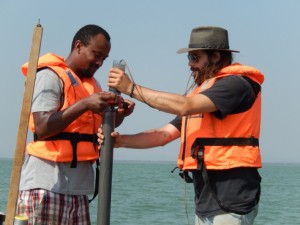
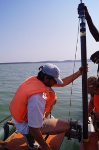
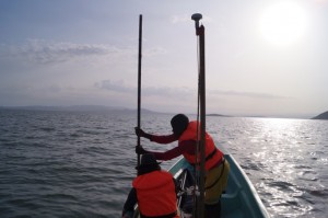
The REAL ESRs from Ghent University carried out field work in Lakes Baringo and Bogoria in the Kenyan rift valley in July. Together with Prof. Dirk Verschuren, ESRs Geert van der Plas and Aynalem Degefa and other members of the Limnology Unit at Ghent University (Gijs de Cort and Yoeri Torsi), were involved in the first round of data collection. Single-drive piston cores and gravity cores were retrieved from various parts of the lake basins. Bathymetric measurements were carried out in Lake Baringo using an echo sounder to measure water depth and probing to measure lake sediment thickness.

Bogoria   Baringo1

Baringo2   Probing

Coring and probing at Lakes Bogoria (top left) and Baringo (the rest)
 

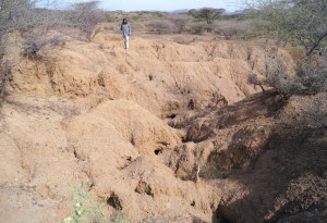
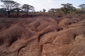
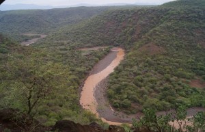
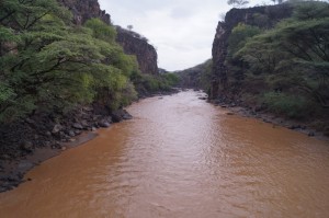
After coring the lakes we covered various parts of the Lake Baringo catchment with the intention of collecting soil samples from the major river sub catchments feeding Lake Baringo. High density of gulley channels were observed in different localities with fine grained soil. The major rivers were all heavily sediment loaded.

gully2   gully1

Deep gulley incisions in surface soils, Marigat-Loboi plain


Perkera1   Perkera2

Perkera River flowing through a deep gorge near Radad village (left), and red ocher colored river water due to heavy sediment suspension, further downstream near the town of Marigat
 

Further analyses of the fossil pollen and geochemical signatures of the lake sediments will be carried out in the lab with the aim of reconstructing past environmental changes, land use, and vegetation history of the Baringo and Bogoria areas.

Photos by Aynalem and Geert
Share this:

  • Click to share on Facebook (Opens in new window)
  • Click to share on LinkedIn (Opens in new window)
  • Click to share on Twitter (Opens in new window)
  • Click to share on Pinterest (Opens in new window)
  • Click to share on Tumblr (Opens in new window)
  • Click to share on Reddit (Opens in new window)
  • Click to share on Google+ (Opens in new window)
  • Click to email this to a friend (Opens in new window)
  • About us
  • People
  • Projects
  • Training
  • Resources
  • Contacts

Site information

REAL is a Marie Curie Actions InnovativeTraining Network (ITN), funded by the European Commission under the Seventh Framework Programme.

Find us on Facebook:

Find us on Facebook:

Coordinating partner

Prof. Paul Lane
Department of Archaeology and Ancient History,
Uppsala University, and
Department of Archaeology, University of Cambridge

Copyright © 2023

loading Cancel
Post was not sent - check your email addresses!
Email check failed, please try again
Sorry, your blog cannot share posts by email.