REAL

Resilience in East African Landscapes

  • Welcome
  • About us
  • People
    • Advisory Board
    • Researchers
      • David Anderson
      • Franziska Bedorf
      • Michael Bollig
      • Lowe Borjeson
      • Colin Courtney Mustaphi
      • Benoit Hazard
      • Paul Lane
      • Rob Marchant
      • Dirk Verschuren
      • Mats Widgren
    • Early Stage Researchers
      • Christine Adongo
      • Maxmillian Chuhila
      • Chris de Bont
      • Aynalem Degefa
      • Esther Githumbi
      • Marie Gravesen
      • Rebecca Kariuki
      • Eric Kioko
      • Nik Petek
      • Annemiek Pas Schrijver
      • Anna Shoemaker
      • Geert van der Plas
    • Associate Partners
  • Projects
  • News
    • REAL News
    • Conferences and workshops
    • Training
    • Fieldwork
    • Outreach
  • Resources
    • Cartography and Geospatial
      • Maps and Data
      • GIS Tutorials and Resources
    • Links
    • Research Permits
  • Publications
    • REAL Publications
    • Laboratory Protocols
    • Lexicon
    • Library Archive
    • Palaeo- Glossary
  • Contact us
  • ARCC Project 2017-2021
    • ARCC project overview
    • ARCC blog
  • Annemiek Pas Publications
  • BSX

Survey of Kenya visit

The Survey of Kenya, with headquarters in Nairobi, was involved in field mapping alongside the Directorate of Overseas Surveys and Directorate of Colonial Surveys during British colonial rule and remains the main centre of geospatial information in Kenya.

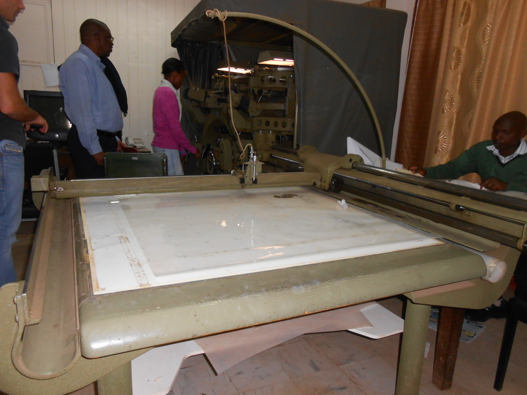
The Survey maintains the air photography, maps, cadastrals and geospatial data of Kenya and is an important component to improving land ownership and jurisdictional boundaries in the country. These are critical functions toward political goals in the Ministry of Land, Housing & Urban Development. The Survey is rapidly expanding with new infrastructure, an institute for training personnel, and new developments. Some infrastructure was a legacy of the colonial administration and was shown to some REAL members and Dr. Martin Skrydstrup during a visit in May, 2014.

Some details about what is available can be found here.

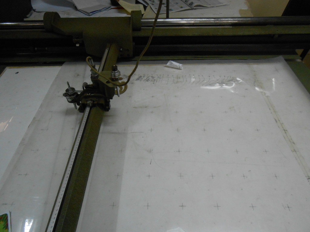
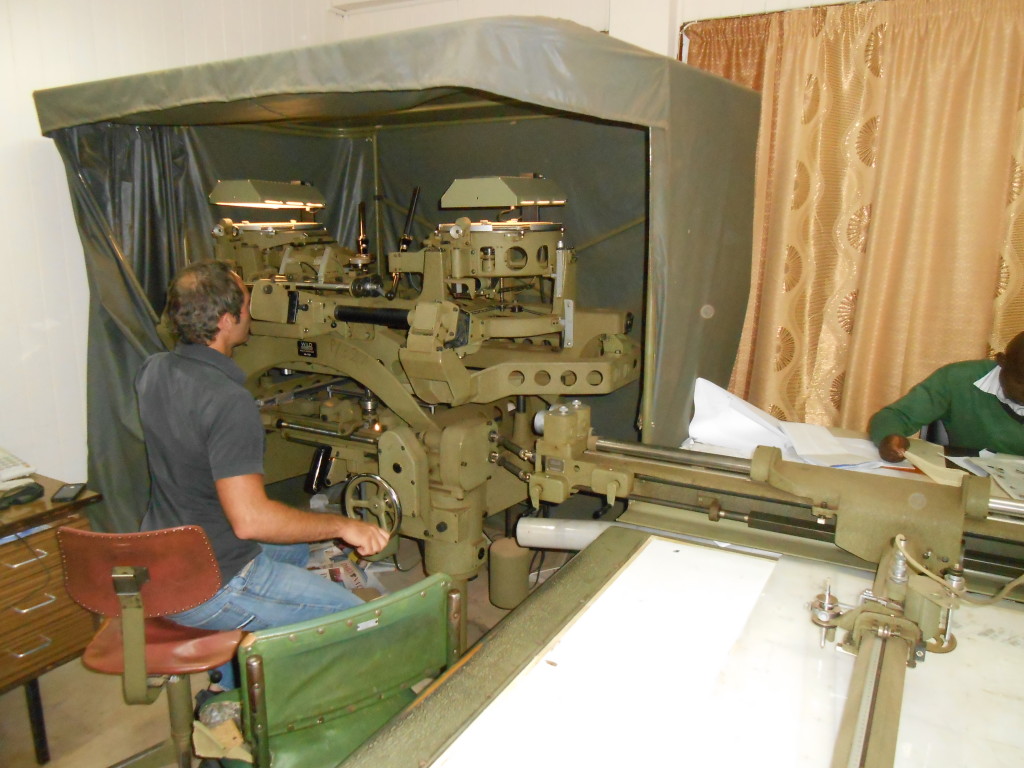
Here are some photos of a Wild Heerbrugg model A8, an analogue photogrammetric instrument, used to view air photos and draw contours and features for map printing. This model was phased into the market in 1952 and was available until 1980 (Hughes et al., no date).

DSCN0244

DSCN0245

DSCN0246


References:

David Hughes, Peter Fricker, Alain Chapuis, E. Traversari, P. Schreiber, F. Schapira. No date. The Development of Photogrammetry in Switzerland. English Version.  Available online, accessed 20 May 2014: http://www.wild-heerbrugg.com/photogrammetry1.htm 
Share this:

  • Click to share on Facebook (Opens in new window)
  • Click to share on LinkedIn (Opens in new window)
  • Click to share on Twitter (Opens in new window)
  • Click to share on Pinterest (Opens in new window)
  • Click to share on Tumblr (Opens in new window)
  • Click to share on Reddit (Opens in new window)
  • Click to share on Google+ (Opens in new window)
  • Click to email this to a friend (Opens in new window)
  • About us
  • People
  • Projects
  • Training
  • Resources
  • Contacts

Site information

REAL is a Marie Curie Actions InnovativeTraining Network (ITN), funded by the European Commission under the Seventh Framework Programme.

Find us on Facebook:

Find us on Facebook:

Coordinating partner

Prof. Paul Lane
Department of Archaeology and Ancient History,
Uppsala University, and
Department of Archaeology, University of Cambridge

Copyright © 2023

loading Cancel
Post was not sent - check your email addresses!
Email check failed, please try again
Sorry, your blog cannot share posts by email.